Official visual companion
Inside GeoBusiness Intelligence Studio
A Visual Guide to Open Data, Geospatial Discovery, and Local Business Intelligence
Faramarz Kowsari · Version 1.2.0 · DOI 10.5281/zenodo.21539094
01Purpose
Why build a local-business intelligence laboratory?
Business-location data often arrives fragmented: names vary, addresses are incomplete, contact fields disappear, and the same place may appear more than once. GeoBusiness Intelligence Studio converts that ambiguity into an inspectable pipeline.
02Providers
One interface, three data paths
Offline fictional samples support predictable demonstrations. OpenStreetMap uses Nominatim and Overpass with safeguards. The optional Google Places adapter uses the official API and the user's own restricted key.
03Workflow
From a query to an exportable dataset
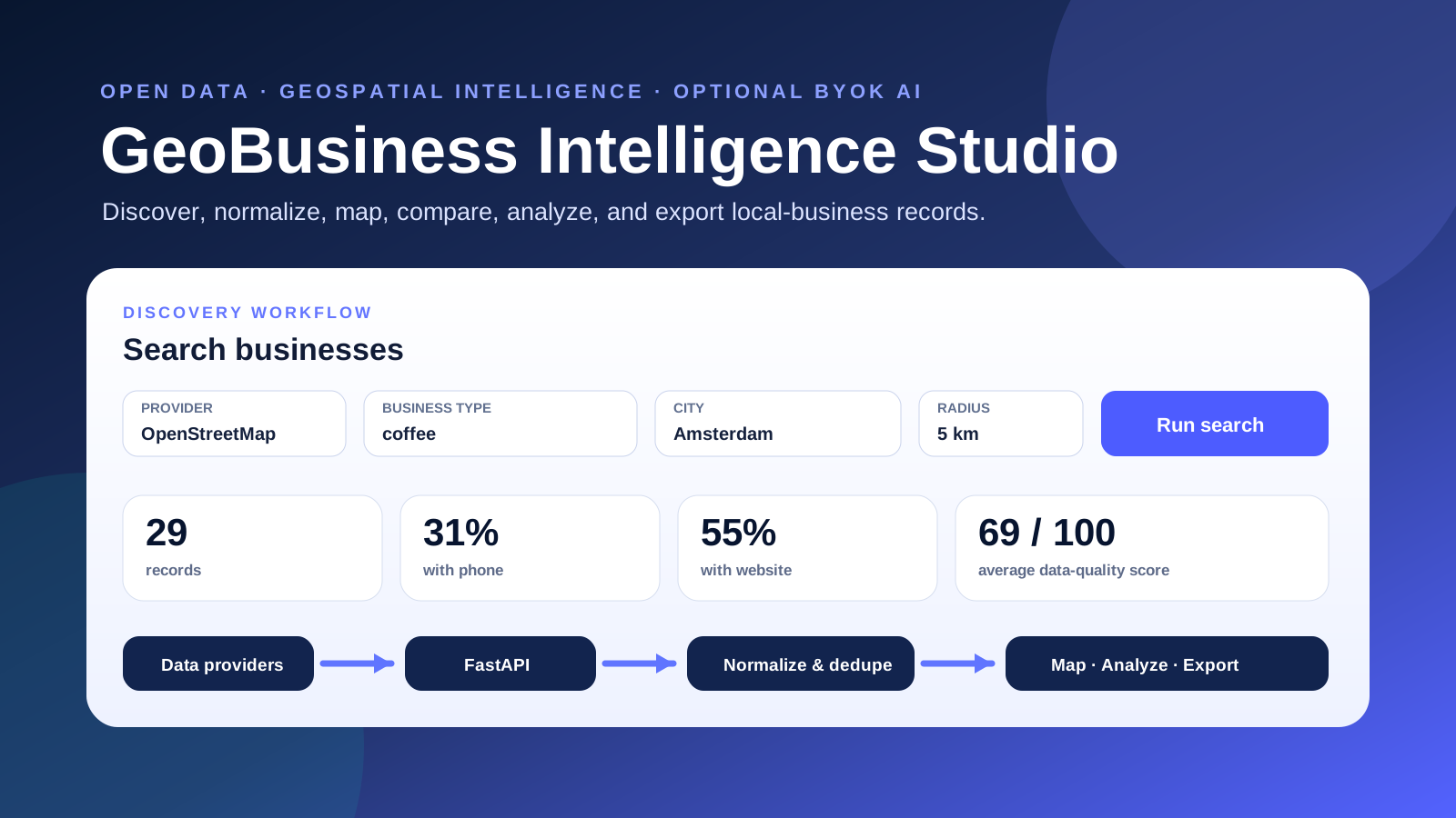
Choose provider, business type, city, radius, and limit. Resolve geography, retrieve records, normalize fields, score completeness, remove probable duplicates, map results, summarize coverage, and export CSV or JSON.
04Interface
A dashboard that keeps evidence visible
Search controls expose provider and geography. Metric cards reveal coverage and average quality. The map preserves spatial context, while tables keep source, contacts, ratings, and quality visible.
05Architecture
FastAPI at the center of replaceable components
Provider adapters feed validated FastAPI routes. Search orchestration performs normalization, quality scoring, sorting, and conservative deduplication. Static HTML and Leaflet provide the browser interface.
06Data quality
Completeness is measured; identity is inferred cautiously
The quality score measures the presence of useful fields, not factual correctness. Duplicate detection combines stronger evidence such as matching phone numbers with softer evidence such as similar names and addresses.
07Privacy, AI, and deployment
Useful without AI; extensible when AI is justified
The deterministic workflow is complete without AI. Ollama and OpenAI-compatible endpoints are optional. The project supports Render, Docker, source execution, and a verified one-file Windows edition.
08Use cases and citation
Research value with permanent distribution
Use the project for market orientation, data-engineering education, responsible-AI demonstrations, and portfolio review. Version 1.2.0 is preserved on Zenodo and identified by a permanent DOI.
09Author
Faramarz Kowsari
Faramarz Kowsari is an author, Software Engineer and AI researcher based in Istanbul. Official profiles include ORCID, Google Scholar, GitHub, LinkedIn, and Google Books.
- ORCID: https://orcid.org/0000-0003-1692-0453
- GitHub: https://github.com/FaramarzKowsari
- Project: https://github.com/FaramarzKowsari/geo-business-intelligence-studio
- DOI: https://doi.org/10.5281/zenodo.21539094
The map becomes intelligence only after the uncertainty remains visible.
10